Day 14: Papakauri Hut to Whananaki

-35.513949, 174.453266
38km Day : 308km Total
The rain came last night soon after settling down last night.  It was a light but steady rain for several hours and reinforced my confidence in the tent. 
I didn’t get started this morning until almost 8:30.  And then almost immediately stopped at the stream to refill my water supply.  So it turned into a relatively late start. My original intent today was to hike up to Hansen’s Hill, a 28km hike. But at one of my morning rest breaks I reread the track notes and realized that camping was not allowed on this track.  The next available place for me to stay was at the North Whananaki Holiday Park, an extra 10km away.  So again the day turned out to be a race against the setting sun.  With a lot of hills in the final 15km to add to the difficulty. 
The majority of the day was spent hiking roads.  The difficulty was that the roads were around blind curves with very narrow road shoulders, and in some places none.  It required care to be sure you had a safe place to be when cars passed.  Fortunately there wasn’t a lot of traffic and you could hear the cars coming with about 10 seconds of warning.

image

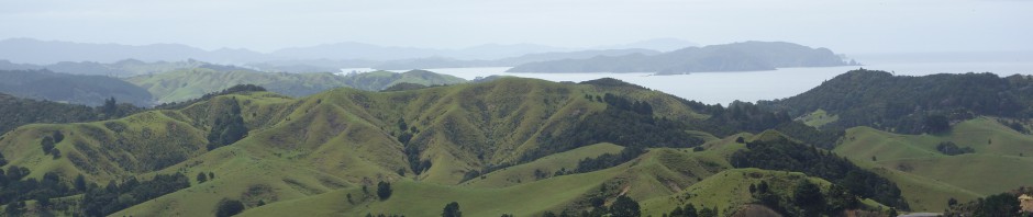
I reached Morepark track at 4:30.  Not good because the estimate for this track is that it takes 3 to 4 hours to complete, ending near Whananaki.  I had little margin for error, because it starts getting dark around 8pm.  I managed to emerge from the forest at 8 o’clock (still light, barely),  then 1 more kilometer through bull pastures in the twilight.  The final kilometer was walking on the road in the dark to the Holiday Park, the entire way wondering what I would do if the reception office was closed.  I got a wonderful reception from the park owners, Matthew & Tracy, as well as Sharon & Joerg who arrived before me.  They were all a little worried about me because at that point I didn’t look (or smell) very good, and I was absolutely exhausted.
Matthew & Tracy put me up in a cabin and even offered to cook me a meal, which I humbly declined.  But the hot shower and the mattress to sleep on were greatly appreciated.  I highly recommend this park to anyone traveling or hiking through Whananaki, due to the owners’ amazing hospitality.

Posted in Uncategorized | Leave a comment

Day 13: Piahia to Papakauri Hut

-35.363434, 174.274324
23km Day :  270km Total
The forecast today was for rain in the evening.  So I got off to an early start (6:20) to be sure of finishing the walk of Papakauri Stream before the rain started.  The morning started with a 4km walk along the bay to Opua just in time to watch the ferry leave that I was hoping to catch.  Which turned out well enough, because it gave me about 15min to stop at the general store for a coffee an something to eat. I caught the 7:30 ferry across the bay to Okiato at the cost of $1. 
The rest of the morning was spent walking the roads around the East side of the bay to arrive at Waikare at 12:30.  (Notice the official day mileage was 23km, my actual distance walked was 35km.  This is because the official distance is based on taking the water taxi (11km) instead of walking the roads (23km)).
Then it was additional gravel roads and well developed trails mostly along the Papakauri Stream.  The final 4 km of the walk was in the stream bed itself.  A beautiful walk and not difficult except for a 200m section with large smooth rocks that were slippery.

image

 I arrived at Papakauri Hut around 5pm.  It is not a hut in the sense of 4 walls and a roof.  It is a covered shelter, just enough to get out of the rain with seats and a raised table.  There is an old drop pit toilet up the hill behind the hut.  But the floor boards are decaying, so you need to be careful how you distribute your weight or you may fall through.
After setting up camp and making supper I was joined at the camp by Sharon and Joerg. An American and a German also hiking the trail. 

Posted in Uncategorized | Leave a comment

Day 12: Kerikeri to Piahia

-35.300628, 174.101859
25km Day : 247km Total
Today started with a 2km walk that didn’t count in the mileage.  The trail is actually 2km east of town so I had to get back to the point I left the trail on Wednesday before I could start counting official mileage again.  Then I proceeded to take an unintended 10min sightseeing tour around the peninsula before getting back on the right trail. 
On the way out of town I met two other Americans also doing the TA Trail. We stopped to consult on the right way out of town, but as we were traveling at different paces we said our farewells and moved on to our separate hikes. 
The morning consisted of mostly walking gravel forestry roads.  It was easy walking in pleasant surroundings.  Around ten o’clock the sky went dark and it started to rain so I rushed to get my wet weather gear on, but by the time I had it on the sun came back out.  I saw this same sort of thing happen on 90 mile beach.  I’m beginning to get the impression that cloud bursts on an otherwise perfect day are a common thing in New Zealand.
The scenery changed to a golf course on the shoreline around 1pm.  Then I reached Te Ti Bay at 1:30 where I stopped for fish and chips while sitting on the beach taking a long rest break.  Moving on to Piahia there were just amazing views of the bay and the tourism industry was taking full advantage of it.  Heaps of motels, restaurants and local tours to be found here.
The final 2km I walked along the Veronica Channel in a mix of beach walking and scrambling over volcanic rock formations.  Apparently I was suppose to take the trails above the rocks but missed them.  I even did a little wading in the surf in parts because the tide was up.  A lot of fun!  Overall a great day!
Camping at the Beachside Holiday Park tonight with my tent 10m from the beach.

image

Posted in Uncategorized | Leave a comment

Day 11: Kerikeri

-35.229302, 173.941547
0km Day : 222km Total
Today was my first “Zero” day.  I spent it doing laundry, resupplying at the grocery, stopping at the sporting good store for a few tent pegs. They didn’t have a decent replacement for my broken trekking pole so that will need to wait until Whangarei.  This zero day is also allowing my aches, pains, cuts, scrapes and bug bites a chance to heal.   The midges really got to my legs when I was tramping the streams a few days ago and the bites still itch.  But my biggest concern is my right knee, which aches on the downhill sections.  Hopefully this extra 24 hours of rest will improve it.  Otherwise all is going great and I’m looking forward to starting the next trail section tomorrow morning.  With one last stop at Macca’s for breakfast.  :).  The photo below shows a mussel burger and chips at a local Kerikeri takeaway.   mmmmm

image

Posted in Uncategorized | Leave a comment

Day 10: Forestry Camp to Kerikeri

-35.229302, 173.941547
25km Day : 222km Total
Last night I got the first good rain of the hike.  It was a good test for the tent, and gives me more confidence in it.  It is much lighter than my last tent so I had doubt’s about it until now.  It was a very windy day and at times had to lean heavily into the wind to keep from being blown over. 
The day included walks through a sheep farm, a cattle farm, road walks and well tended trails along the Kerikeri River.  The last 4km seemed to last much longer than it should have.  Probably because I was so looking forward to a bed, a shower and eating some junk food.  Also, I had it in my head that once I reached the Kerikeri river I was almost there.  But I still had 8km left to go.
Crossing the sheep farm I ended up relying on map and compass and GPS, because the trail markers were few and far between.  As I was crossing the cattle farm there were many fences to cross by way of stiles.  At one stile there was a whole herd of cattle waiting for me immediately on the other side.  To keep from panicking the herd I moved slowly and sang softly as I passed through them. 
Tonight I’m staying at the Holiday Park in a motel room, with the luxury of a bed and hot shower.  I already had a pizza and will eat at Macca’s tomorrow.  What glorious indulgence!

image

Posted in Uncategorized | Leave a comment

Day 9: Pukatea Ridge to Forestry HQ Camp

-35.211372, 173.793949
12km Day : 197km Total
Today was another choice between a long and short hike due to locations of available accommodations. This time I chose a short day and didn’t start until 10:30 and arrived at camp by 3:30 making it a leisurely pace.  The tracks in the forest were easy to walk and the absence of mud made it like a walk in the park by comparison to Raetea.  The highlight of the day was seeing 2 Arapawa Goats on the trail. 

image

Posted in Uncategorized | Leave a comment

Day 8: Omahuta to Pukatea Ridge

-35.233228, 173.70447
14km Day : 185km Total
Today started with a 5km walk of gravel roads and forestry tracks with a large number of beehives along the way.  So there was a constant buzzing in the air as I walked.  At the turnoff to walk down to the stream the track notes mentioned a “rough” track to turn left on so I spent about ten minutes looking for a foot-wide trail similar to the rough tracks in Herekino.  But after getting out my GPS I realized they were referring to the wide but grass covered track I was already on.
When I reached the Mangapukahukahu stream I knew this was going to be a low mileage day because it was a beautiful stream and I decided to take full enjoyment of it and the perfect weather.  Before going further I stopped for a leisurely early lunch of ramen noodles with peanut butter and crackers for desert.
The track from this point is actually the bed of the stream so the day consisted of a lot of wading through water that was up to knee deep.  After about an hour I stopped at one of the stream’s side pools for a break and took a short swim.  Actually very short because the water was chilly.  But it was refreshing, and I sat in the warm sun to drip dry. (A beach towel was not something that I had considered including in my backpack 🙂 )
When I reached and crossed the Waipapa River shoals the intent was to continue wading the riverbed upstream, but at that point the river was above waist high so I found the alternative trail route above the river, which started out as good trail, but I soon regretted my decision to take the trail.  It is a very difficult and dangerous trail, at points only 6 inches wide with a shear drop to the left and a nearly vertical slope up to the right.  I was constantly looking for a safe way back down to the river, at this point willing to swim it if necessary.  After about an hour of this I finally got back down to the river and waded the final kilometer of the river which was now only knee deep.
I reached the start of the Pukatea Ridge at the edge of the Waipapa River in the early afternoon and set up my tent in a small camping area. 
Except for the short difficult trail above the river, this was my most enjoyable day so far.

image

Posted in Uncategorized | Leave a comment

Day 7: Raetea to Omahuta Forest

30km Day : 171 Total
This morning I had to decide between a low mileage or high mileage day, because there are few options for putting up a tent between the two forests.  And I had not progressed as far yesterday as I had hoped, so I still had 12km of the hills and mud of Raetea to slog through.  So my options were to walk 12km to the edge of Raetea forest or to walk 30km to the edge of Omahuta forest. I estimated I’d have a walking speed of 2km/hr in Raetea and 5km/hr on the roads in between.  Considering breaks, etc, I estimated I could walk the 30km in 12 hours.  Putting me in Omahuta around 7:30pm. A long, hard day but doable, and I really wanted to get out of the mud of Raetea.
An hour into the day’s walk I reached Raetea summit.  The views were amazing and made the walk through all of that mud totally worth it.  I emerged from the forest at 2:30, an hour later than estimated.  Now I was on a race against time to make it to Omahuta before dark.  First stopping at a stream to top off with water and to clean off the worst of the mud (which was already considered in my time estimates).  Then it was a power-walk to Mangamuta Bridge, arriving at the shoppette at 4:30pm to find a sign that they closed at 3pm on Sundays (as if I knew today was Sunday).  But the family that runs the store was still inside cleaning up and allowed me in with amazing kindness, to pick a few choice items off the shelves.  The cafe was closed as well, but I wouldn’t have had the time for it anyway.  Then back on the road to continue my walk in a race against the setting sun.  I arrived exhausted at the edge of the forest at 8:30 just as it was getting dark,  and by the time I found a suitable spot and put up my tent it was completely dark, using my headlamp to finishing setting up my tent.

image

Posted in Uncategorized | Leave a comment

Day 6: Taumatamahoe to Raetea

-35.212047, 173.401418
20km Day : 141km Total
I woke up just before dawn this morning to the sounds of various bird calls that I didn’t recognize.  They made for a unique combination of sounds.  It reminded me of the discordant but somehow enjoyable music made by an orchestra as they are tuning their instruments just before they begin a presentation.
I had high hopes this morning for an easier, high mileage day, since we only had 3km left of Herekino, and then onto forestry lands.  Although we were a little concerned about arriving at Raetea forest which rumores held was even more difficult than Herekino.
Fabi and I got started soon after 7:30 and quickly realized Herekino wasn’t going to release its hold on us easily.  The final 3km was downhill, which for me is more difficult than uphill on these steep muddy slopes.  I managed to fall twice; breaking one of my trekking poles and wrenching my knee a bit in the process.  And somewhere on this section I lost my cap.
After spending an hour and a half working our way out of the muddy forest it suddenly opened up with a panoramic view of rolling farm land.  It was almost like in the Wizard of Oz when Dorothy gets her first view of Oz and the movie changes from black & white to color.   Fabi turned to me to say,  “I hope I never get so used to seeing such amazing views on the hike that I don’t stop to appreciate them.” I had to agree with this sentiment.
Another kilometer along the track we came to a stream.  I needed to refill my water, but Fabi didn’t.  And at this point it was clear we hiked at different paces. (The middle aged American could not keep up with the young German.) So as much as I enjoyed Fabi’s company, this was a natural point for us to continue on our own hikes separately. I still may catch up with him in Kerikeri when he stops for resupply there.
As I filtered and refilled my water supply I saw this as a good opportunity to clean the mud from my shoes and pants so ended up spending close to 45 minutes at the stream but felt much better (and cleaner) for the time spent.
In the forestry lands there is an unmarked minor fork you must take, and I missed it and stayed on the main track. I went 500m beyond it before realizing the mistake.  So between misadventures in Herekino and this wrong turn, this morning was a less than an ideal start to the day.  It was already 11am and I had only traveled 6km. (7km if you count the wrong turn). 
Raetea forest has not so far shown itself to be nearly as difficult as Herekino.  But it is still a challenging track and I expect to have a slow going tomorrow morning.  I’m camping tonight just to the side of the trail, about a mile west of Raetea summit.  I’m very pleased the rain has held off so far.  Looking forward to a real meal at the cafe in Mangamuka Bridge.

image

Posted in Uncategorized | Leave a comment

Day 5: Ahipara to Taumatamahoe

-35.187583, 173.26456
20 km Day : 121 km Total
This morning I saw Chris and Tony at Ahipara before I left.  I had last seen them on Day 1. They were taking a day off from hiking today, but I’m sure I’ll see them down the track again at some point.
Today started with walking 8km on roads to get to the start of the forest track. The Herekino Forest track was very muddy with steep hills.  The first 5km of this track took me 3.5 hours to complete.  It is very slippery clay, so on the downhill sections I needed to be very careful not to end up sliding down the hill as if I was skiing it.  The trekking poles came in very handy for keeping balance when one of my feet would slide.  I’m sure you can imagine how difficult it makes uphill slopes as well.  There were many close calls for falling full on into the mud, but I managed to keep on my feet somehow.  A low mileage day due to the conditions.
I’m camping on top of Mount Taumatamahoe.  Just East of the summit there is a small, flat, dry clearing, enough for about 3 small tents.  This is a jewel of a spot because there are very few places in Herekino that are dry, flat or clear.  To find all of these qualities in the same place felt almost miraculous as I approached exhaustion after slogging through mud, up and down hills all day.
An hour after I settled in, a German hiker named Fabi stopped to camp as well.  We commiserated for a while about the difficulty of this track, when Fabi commented on how much more difficult it would be if it were raining too. (nearly impassible).

Posted in Uncategorized | Leave a comment