Day 50: Boyle River to Windy Point and Hanmer Springs

14km Day : 915km Total
12 February 2015

This morning I slept in late and packed up my tent for the 4km walk to the highway with the intent to hitchhike to Hanmer Springs from there.  After a kilometer there was a swing bridge crossing the Boyle River and on the other side were Ryan and Robbie.  We gave each other a Hey There wave from opposite sides of the river.

When I reached the shelter at the highway i began repacking my bag a bit to prepare for hitching.  While i was there Andrew was dropped off after spending yesterday in Hanmer.  He suggested that since i was planning to spend tomorrow in Hanmer, that i walk the additional 10km of trail to Windy Point today and hitch from there.  This would give me a start on the next trail section when I return.  A great idea I hadn’t considered, so after a short talk with him I put my pack back on for another 10km of tramping.  Andrew was stopping in at the Outdoor Education center to pick up a package he had forwarded before continuing.

Just another kilometer away the trail required a wading of the Boyle river.  With the rains from two days ago the river was a little high and fast and cold.  There were a few meters of crossing where the water was knee high with a quick flow.  If it had been any faster or deeper I may have reconsidered this crossing.

image

On the other side I met Ryan and Robbie who were taking a break along the river.  They are not stopping to resupply here as they packed enough food in St Arnaud to get them to Arthur’s Pass.   After a brief catch up discussion I moved on.

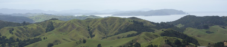
A few more kilometers on there was a crossing of the Doubtful River that was definitely swollen.  I had to walk an additional 100m upstream from the marked crossing point, which was fast and deep enough that I was concerned about crossing,  to find a wider crossing point where the fast flowing water was not as deep.

image

image

image

After a while I came to a fence with markers indicating a detour right, taking me away from Windy Point.  At first I wasn’t concerned, but then the marked trail took me even farther away from the river and into the hills.  At this point I got out my GPS to see where it was taking me.  I was on Tui Track, which eventually joins back up with the TA but doesn’t go by Windy Point.  This is one of those places where the TA map and the TA notes do not agree.  The map indicates to walk directly through this 2m high fence, but the notes say to take the Tui trail around.

I ended up taking Tui trail up to the Hope-Kiwi track and backtracking this trail to Windy Point at the cost of 3km more trail than planned. 

At the Windy Point intersection I found Andrew sitting and taking a break.  I asked him where I took a wrong turn.  He said I didn’t, but when he saw the trail didn’t match the map he ignored the markers and climbed over the fence to stay on the mapped route.  I think Andrew must be a genius, or I’m just really dumb.

image

From there it was just a short walk out to the highway where after only a short time i got a ride out to the highway intersection for the road that leads to Hanmer.  Here I found Sharon thumbing for a ride back out to Boyle Village after staying the night at Hanmer.  Just up the road I stopped at a cafe for a toasted ham and cheese. 

I was still 8km from Hanmer but had bad luck at getting a ride.  I don’t hitchhike much so I imagine I’m just bad at it.  After standing with my thumb out for a while with no luck, I started walking and stopping to stick out my thumb at each car.  No luck at this for about an hour I finally just gave up hitching and walked the rest of the way in, keeping my thumb to myself.  So if you add this 8km and the extra 3km on the Tui track the day’s true walking distance was 25km.  Arrived in Hanmer Springs at 6pm.

Posted in Uncategorized | Leave a comment

Day 49: Anne Hut to Boyle River Camp (3km East of Boyle Village)

25km Day : 901km Total
11 February 2015
-42.519042, 172.415702’9

Anne Hut is a big hut and with only 4 of us sharing it last night, so I ended up with a big sleeping flat to myself when I went to sleep.  So I was surprised this morning when I woke up with someone sleeping on the other end of it.  Nick from Brisbane came in at 11pm last night.  He is doing the TA Trail in the South Island by paragliding from mountains wherever possible.  He climbed and glided off of 5 hilltops yesterday.  Pretty cool!

I left the hut this morning considering several options for the next couple of days.  I left at 7:15 to give me the full range of possibilities without needing to rush for any of them.  The main options were to camp near Boyle Village and hitch in the morning to Hanmer or to push to Boyle Village and hitch to Hanmer this evening.

image

image

image

Colin & Graeme on a Tea Break

It was nice walking through river valleys all day.  Throughout the morning I walked off and on with the Kiwis and Sharon (from Hawaii).  I reached Boyle Flat Hut for lunch where I was joined by Sharon.  Colin & Graeme continued on without stopping for lunch, with a deadline of meeting Colin’s wife at Boyle Village.

image

After the hut the trail started leaving the grassy flats and traveled through more of the woodlands above the river.  Occasionally coming back to the grasslands.

image

image

Fancy Stile

Today I saw a lot of geese.  When I first saw some in flight my thought was Canadian Geese.  But even though Canadian Geese have a long migration, I doubt they fly all the way to New Zealand. I just did a little research online and discovered that Canadian Geese were introduced in New Zealand in 1905 as a game bird.

image

Canadian Geese

I’ve camped along the Boyle River.  It will be a short walk in the morning to the village where I can either hitch a ride to Hanmer or catch the 10:20am shuttle bus.

image

Freedom Camp

There must be close to a hundred sand flies on my mosquito netting.

image

Sand Flies

Posted in Uncategorized | Leave a comment

Day 48: Caroline Bivvy to Anne Hut

29km Day : 876km Total
10 February 2015
-42.351074, 172.528779

It was a chilly start to the day, and having to put my wet clothes back on made it seem even colder.  But once I got the blood flowing with a little walking it was bearable. 

My legs stayed wet for a long time due to walking through wet, waist high grass for most of the morning.  But the real eye-opener was having to start the day with a knee deep wade through the ice cold Waiau River.  My feet were nearly numb for half hour afterward.

image

Camping Outside Caroline Bivvy

image

Leaving Caroline

image

The Morning Walk

It was quick easy walking all day through grass fields and on 4wd tracks.  With great views of the mountains and following rivers all day.  The afternoon warmed up and dried out the grass and my clothes.

image

image

Waiau River

image

Henry River

As I approached Anne Hut I could see it from almost a kilometer away across a wide grassy field.  My first thought was, wow, Little House on the Prairie.  My second thought was, Why is it here?  The map shows it another mile down the track on the other side of the river.

At the hut I found Graeme and Colin, who I expected to see.  To my surprise Sharon was also there, who I haven’t seen since Ngunguru back in November.  I mentioned the unexpected location of the hut to Graeme and he said that the old one burned down a couple of years ago but the maps haven’t yet caught up with the location of the new one.

Posted in Uncategorized | Leave a comment

Day 47: Blue Lake to Caroline Bivvy

13km Day :  847km Total
9 February 2015
-42.153627, 172.660025

Today was the most challenging day of hiking so far.  All three of us woke up before dawn to get a good start.  Graeme and Colin were very efficient in making breakfast and packing up, but I was having trouble getting myself moving.  So when they were ready to put on their packs and walk out the door at 6:45, I was making my second cup of coffee to try and chemically induce my motivation.

I stepped out of the hut and into the fog at 7:30.  It was about a 3km walk and 150m climb up to Lake Constance through a rocky and grassy landscape where I could only clearly see about 50m in front of me.  I sometimes had to guess at where the next marker was and got out my compass a few times when the markers weren’t visible after several minutes of searching.

image

Morning Fog

When I arrived at the lake I was disappointed because I couldn’t view much more than the edge of it where I was standing.  I moved on into a marshy, rocky field where I crossed a few small streams that feed the lake.  And then I started the long climb up a steep scree slope to begin the ascent to the saddle. 

After an hour of climbing, the clouds began to dissipate and I got an awesome view of Lake Constance.  I had to stop and sit before taking in the view because the slope was so steep it gave me vertigo to look back and down while standing.

image

Climbing the Scree Slope to Waiau Saddle

image

Looking Back at Lake Constance

Walking up the scree slope required complete concentration with every step.  It was an exhausting climb through the combination of physical and mental effort. 

I reached Waiau Saddle at noon with 30mph gusts coming over the pass and a sprinkle of rain starting.  At the top of the pass I had intermittent mobile phone coverage.  I attempted to send a message, but after it dropped out a couple of times I gave up because it wasn’t worth standing in a rainy gale to make more attempts.

image

The Other Side of the Saddle

On the other side it was a different type of difficulty descending.  There were a lot of boulders to climb over and rocky faces to climb down.  Sometimes I would look over a 3m shear drop to see the next trail marker and say out loud to myself, “How the h### am I going to get down there?”. But eventually i would find a path to do it using both feet and both hands to climb.

Looking down at the river I consoled myself by believing that once I got next to the river it would be a nice easy trail to give my mind and body a rest.  But even at the river there was no real trail.  It was rock hopping with the complication that there was tall grass and small bushes hiding where most of the rocks and boulders were.  So every step for a while required a testing probe.

image

Approaching the Valley Floor

I finally reached the valley floor around 4pm where I took a break at a nice little undeveloped campsite.  After that the trail got much easier to walk, but the sprinkle of rain turned into a solid steady rain.  After an hour of walking in the rain I found Ryan & Robbie taking shelter in Caroline Bivvy which is a tiny shed that has only two bunks.  I squeezed into the building with them to get dry for an hour and have a dinner of salami and cheese on tortillas followed by peanut butter and crackers.

While waiting out the rain a couple of hikers with French accents opened the door but it was clear that no one else could fit in the tiny shelter so they moved on.  When there was finally a break in the rain I went outside and quickly set up my tent for the night.

Posted in Uncategorized | Leave a comment

Day 46: Upper Travers to Blue Lake Hut

15km Day : 834km Total
8 February 2015
-42.058237, 172.655107

All 5 of the TA hikers started from the hut around 7:45 give or take 10min.  It started with a climb to Travers Saddle, which wasn’t as difficult as we expected.

image

Morning at Upper Travers

The views from the saddle were pretty amazing in every direction.  There were a few small patches of snow to the sides of the trail as we crossed over the pass.

image

At Travers Saddle

image

Above the Clouds

image

On the other side it was a steep descent that was hard on the knees. It was a mixture of rock and grass.  I’m not sure which was more difficult because the grass was slippery from dew. Before I realized this I slipped and fell and then slid another meter before stopping.  Nothing injured but my pride.

image

image

The Trail Down to the River

The Kiwis and I reached West Sabine Hut at noon and stopped for lunch.  Bobby & Andrew had already been and gone.  We took our time here because our goal was to reach Blue Lake, which was only a few more hour’s hike.

The final stretch to Blue Lake was harder than I expected with a few steep climbs and some scrambling over boulders required. At 4 o’clock when I had expected to reach the hut I didn’t see anything up ahead that looked like there would be a lake so I got out my GPS to make sure I wasn’t entirely turned around.  The good news was that GPS showed i only had a kilometer left to walk. The bad news was that I had to climb 200m of elevation.

Bobby & Andrew are not at the hut, so apparently they got here early enough that they could get across Waiau Saddle before dark.  The Kiwis and I are the only ones at Blue Lake Hut tonight.  Although two American TA hikers (Ryan and Robby) from Georgia stopped in briefly then continued to Lake Constance to camp.

image

Blue Lake

Posted in Uncategorized | Leave a comment

Day 45: Lakehead to Upper Travers Hut

20km Day : 819km Total
7 February 2015
-42.020551, 172.750205

This was one of the best days hiking I’ve ever had.  Amazing scenery the entire day following the Travers river upstream.  Cool sunny weather, and always the constant sound of water running over rocks, which I find very relaxing.

I left the hut soon after 8am.  The two Kiwi TA hikers (Colin & Graeme) left about 10 min before me and the other American TA hiker (Bobby) left after me.

image

Leaving Lakehead Hut

image

I caught up with the Kiwis a couple hours later when they stopped for a break beside the river on the warm rocks in the sun.(It had been a chilly morning.). After taking a short break myself and having a nice talk with them I moved on. 

image

First View of Mt Travers

image

Typical Sidestream

I reached John Tate Hut at noon and the other three trampers arrived shortly after.  We all stayed to have lunch together for an hour discussing different hikes we’d done and our favorite creative hiking meals.  I’ve found that a lot of discussions with other hikers come down to these two topics.  We left the hut at slightly different times with me being the last to go at a quarter past one.

image

John Tate Hut

I took a very relaxed pace for the day, thoroughly enjoying every minute.  During the final 8km before Upper Travers Hut the trail began to climb , but it was a gradual ascent that roughly followed the river up toward Mt Travers.

image

Forest Trail

The entire day was amazing but if I had to pick the best part it was Travers Falls where I stopped for twenty minutes to take it in.  I made a video of it in the hope to capture the sight and sound of the experience.  The roaring water vibrated the air around me as I sat enjoying the view..

image

Travers Falls

Well, trying to upload the video keeps giving me a “media error”.  So the above photo will need to suffice until I gain more video technical skills.  Trust me.  It was awesome!

image

Bridge Over Troubled Waters

There was a river falling almost straight down the side of the mountain which was a surprising and amazing sight falling about 300m.  The photo below does not do it justice.  This was a very close second for sight of the day award.

image

Almost a Waterfall on Mountainside

As a broke out of the forest, Upper Travers Hut came into view along with a great view of Mt Travers and the pass we will be climbing over tomorrow.

image

Upper Travers Hut

A Canadian TA hiker (Andrew) joined us at the hut.  He started the TA hike in Reinga on the same day as Rory and Joerg and knew them well.  It seems that everyone on the TA Trail knows everyone else with  3 or fewer degrees of separation.

Posted in Uncategorized | Leave a comment

Day 44: St Arnaud to Lakehead Hut

10km Day : 799km Total
6 February 2015

Yesterday was a busy day in Nelson doing laundry, grocery shopping for hiking food, and picking up a few minor gear items.  One of the new items is a plastic fork which I discovered is much better than my spork at stirring up instant pudding. Another item is earplugs, essential for sleeping in busy huts. Thanks for the suggestion Joerg, I will need them tonight.

The off day also gave me a chance to update my blog and upload recent photos to my Panoramio page. There are about a hundred newly uploaded.

I caught a shuttle to St Arnaud at 12:30, arriving at 2pm.  After a stop at the small grocery for a quick snack and drink I got started on the trail. 

image

Lake Rotoiti Seen from St Arnaud

Because of the late start it was a short walk entirely along Lake Rotoiti.  A weather front came through last night and the taller mountains got a covering of snow on them, giving them a more impressive look.  It makes me wonder if I will be walking though snow on Travers Saddle.

image

Lakehead Hut has about 30 bunks and about a dozen of them are being used.  The newlyweds from Wyoming that I met in Queen Charlotte track and saw again on the Richmond track are here.  There are also three other TA Hikers staying the night. Filling out the bill is a family hiking around the lake, including 4 kids.  It’s quite a busy place.

image

Lake Rotoiti -South End

Posted in Uncategorized | Leave a comment

Day 43: Anchorage to Marahau

12km  Day : 789km  Total
4 February 2015

Last night I had a mouse rummaging around in my backpack.  I keep the pack (and a few items including my food bag) in the tent vestibule, which is under the rain fly but outside the netting.  I wasn’t worried about the pack,  and I had little food left since this is the last day of this section hike.  It was just an annoyance that he was keeping me awake.  I couldn’t be bothered to get out of my sleeping bag so I just pushed everything out of the vestibule so it wasn’t sitting right by my head.  Now he could rummage all he wanted to and not keep me awake, or so I thought.

I woke up at 1:30 hearing scratching at the side of my tent.  Now he was starting to piss me off.  I hit the side of the tent to get rid of him.  I certainly didn’t want him scratching or chewing a hole through it.  I didn’t hear him again for the rest of the night and luckily no holes in the tent.  Not even any holes in the food bag, which I half expected to see.

image

It was just a 3 hour walk this morning to the trail head at Marahau.  For the last hour there was a steady stream of hikers coming from the other direction, most of which were senior citizens carrying day packs. 

image

Abel Tasman is set up to be accessible to anyone.  With smooth tracks and closely spaced huts and campsites.  Much easier walking than even the Queen Charlotte track.  But in my opinion the Queen Charlotte has better views. And of course neither of them are comparable to the Richmond track in views (or difficulty).  But having said all that, Abel Tasman is a nice walk with great views and a good choice for someone who is a casual day hiker on holiday. But I’m looking forward to getting back to Te Araroa.

image

Posted in Uncategorized | Leave a comment

Day 42: Araroa to Anchorage Campsite

21km Day : 777km Total
3 February 2015
-40.95687, 173.059193

Last night I kept hearing what I thought was a very persistent mosquito trying to get through the netting.  But this morning I woke up to see nearly 50 mosquitoes between the mosquito netting and the rain fly of my tent.  So I suppose they were all just taking turns to annoy me through the night.

Today was not one of my better days.  I wasn’t feeling very well and my legs itched insanely for most of the day from yesterday’s numerous bug bites.  It was a nice walk through forest with stops at beaches with occasional beautiful views of the bays. 

image

image

image

image

Anchorage is a huge camp with a large hut and space for about 100 tents.  It is too busy and too noisy for my taste and i now wish I had reserved one of the camps on either side of it. 

Posted in Uncategorized | Leave a comment

Day 41: Nelson-Takaka-Wainui-Awaroa

14km Day : 756km Total
2 February 2015
-40.864769, 173.018568

I extended the stay in Nelson for a couple of days due the forcasted rain over the weekend.  I checked out a lot of the cafes and restaurants in town and just had a lazy few days.  I even saw the third Hobbit movie. 

At 8am this morning I caught a shuttle from Nelson to the track head at Wainui Bay to hike the Abel Tasman Track.  This is one of the Great Walks of New Zealand and it required me to book my campsites in advance of starting.  I booked my camps with the expectation of starting to walk at 10:30.  The trick here was that my camp for the first night (tonight) is on the other side of an estuary crossing with only a 4 hour window of low tide for crossing.  By my estimation the 10:30 start would put me about 1 hour into the crossing opportunity.  I got a message last night from the shuttle company that there would be a 2 hour layover in Takaka.  Then this morning the driver informed us it would be a two and a half hour layover in Takaka (I managed to catch 10min of the Super Bowl at the pub).

It turns out I didn’t start hiking until 2:15, nearly 4 hours later than I originally expected.  So this afternoon turned out to be a power walk to beat the tide instead of the leisurely sight seeing stroll I expected. 

It started with a 400m climb up to Gibbs Hill with great views of Wainui Bay.  Then a bush walk to the estuary.  The trails were well developed, smooth and wide enough for two to three people to walk abreast.  A big change from the Richmond Alpine track that I just completed.  But this was expected to be a relaxing side-trip after all.

image

image

Fortunately the DoC is conservative with their safe crossing estimates for the estuary.  I arrived 30min outside the window and was able to cross with just a few knee deep streams to get my feet wet.  The camp was just on the other side.  An hour later the kilometer-wide estuary was full of water from edge to edge.

There is a hut and a large camping area here.  The hut is nearly full but there are only 3 tenters tonight so I had my pick of the many choice spots for my tent.  Nice campground with potable water and flush toilets (and even a foot-washing station!).  The only drawback are the sandflies and mosquitoes of which there are swarms of both competing for my limited supply of blood.  I crossed the estuary in shorts and sandals so my legs were devoured before I had a chance to rug up and apply deet.

The DoC warden came by around 8pm to check our reservation tickets.  He was nice enough to give a description of the upcoming trail and the expected weather for the next couple of days.

Posted in Uncategorized | Leave a comment